Location
OS Map Reference
NZ332302
Know before you go
Dogs
When to visit
Opening times
24/7Best time to visit
Spring, summerAbout the reserve
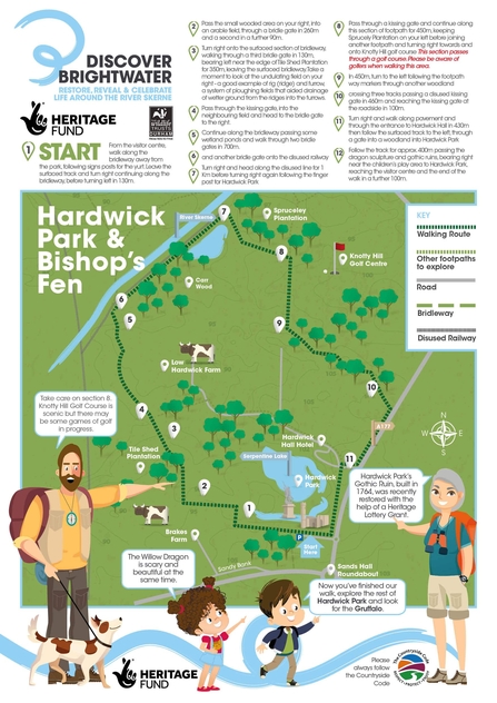
Bishop’s Fen is just at the start of its journey to re-discover to wealth of bio-diversity it once supported. Today there is still loads to see though from flocks of wildfowl and wading birds on the inundated floodplain grasslands to a wealth of wildflower and butterfly and invertebrate life along the well surfaced railway walk.
The improved farmland has developed as result of modification to the River Skerne and its floodplain by industry and agriculture. Centuries ago this area was a rich fenland supporting a rich avifauna which included bittern, egrets and cranes. It is documented as a rich hunting ground for the Prince Bishops of Durham. Its birdlife being served at many a Prince Bishop feast.
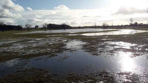
To this day despite all the modifications to the Skerne, the river still floods the surrounding farmland at Bishop’s Fen depositing nutrient rich silts onto to land. After flooding the farmland becomes a haven for water fowl and wading bird species. With species including lapwing, curlew, and golden plover flocking to probe and gleam the invertebrate rich waters and soils on the extensive pasture land.
The River Skerne forms the reserves north and west boundary. This has been straightened by man over centuries and has continued to be dug out by land owners to this day. An impact of much of the improved agricultural land neighbouring the site has been the run off of excessive inorganic nutrients into the river that results in excessive plant growth that prevents fish migration. Soils also erode from cultivated fields, causing sedimentation in the river channels impacting fresh water animals and the material in the river bed.
By securing this site for nature's recovery, Durham Wildlife Trust will be protecting the river from surrounding land use and restoring semi-natural habitats, that were once more common in this historic part of Durham. Bishop’s Fen is just at the start of its journey to re-discover to wealth of bio-diversity that this land once supported.
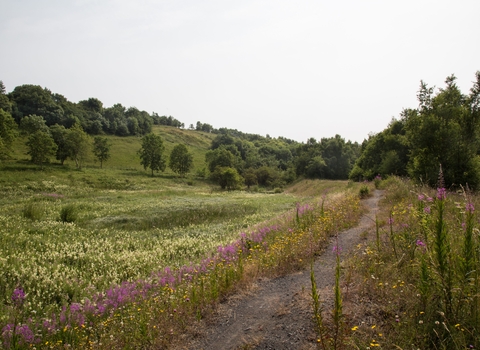
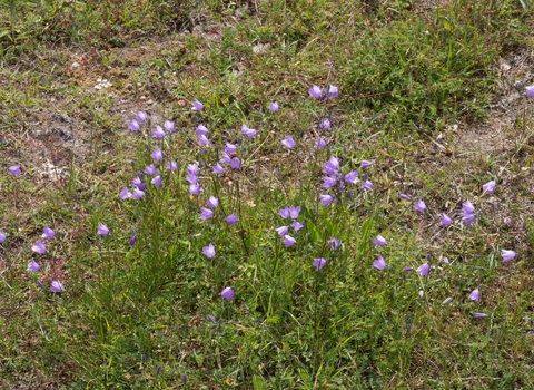
Essentially the reserve is divided in two by an old mineral railway running along the River Skerne. This long linear strip now forms the main access through the reserve. Either side of this central path are strips of species rich grassland of varying quality and character. Wider areas support a shorter sward grassland including; kidney vetch, eyebright, fairy flax, mouse-ear hawkweed and agrimony.
Further west along the line the composition becomes represented by taller herbs including greater knapweed, before moving into areas where common knapweed becomes more frequent along with great burnet, meadowsweet and meadow vetchling. Common spotted orchid, northern marsh orchid and bird’s-foot trefoil are also present.
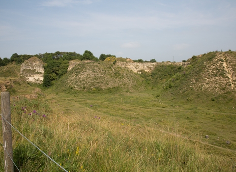
An area of fen can be found at the sites eastern end. Developed from an old large pond it is now dominated by pond sedge with a number of aquatic plants around its margins. Willow carr surrounds this.
On the northern bank of the old pond is a large upright pipe. This pipe is a bore-hole used to monitor ground water levels. Mine pumps once drained the areas natural aquafer to allow for deep mining to take place. Since mining ceased and the pumps have subsequently been decommissioned the natural aquafer has restored bringing ground water much closer to the surface. Today when groundwater levels are high, hydraulic pressure results in water streaming out the top of this borehole pipe.
Ground water being much closer to the surface means surrounding farmland is wetter for longer periods of the year. Ideal for wading birds. The farmland of Bishop’s Fen lies either side of the old railway line, often obscured by native hedgerow. A footpath runs south to north (from Hardwick Hall to Bishop Middleham) through two of the pastures. This provides a glimpse of the pools that occur in these fields and the birdlife that makes use of them through the year.
A further two larger pastures are present, forming the main body of the site to the south west. These large pastures will be the focus of habitat restoration in coming years with the development of fen, scrapes and pools and wet grassland that will support the wetland bird interest of the site year round.